Myanmar - ethnicity
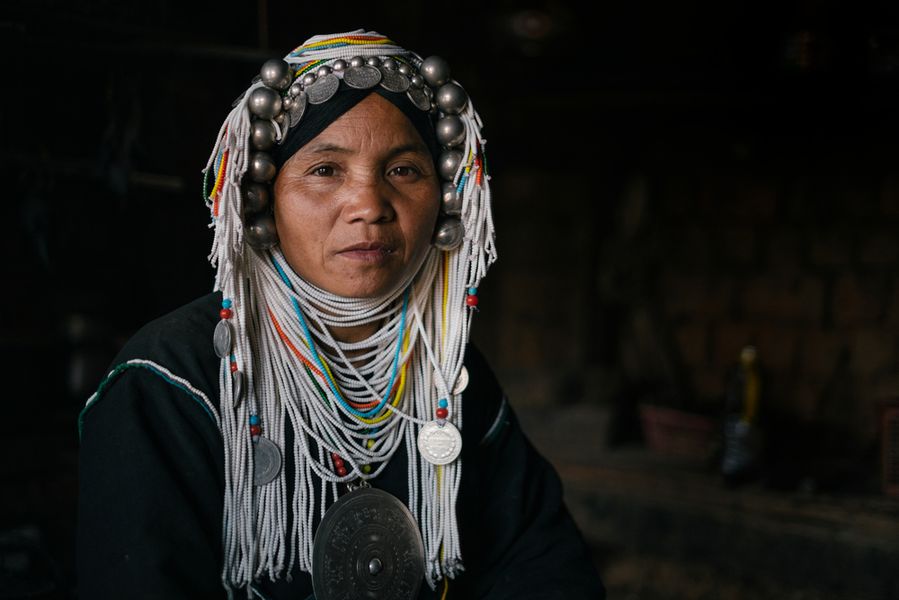
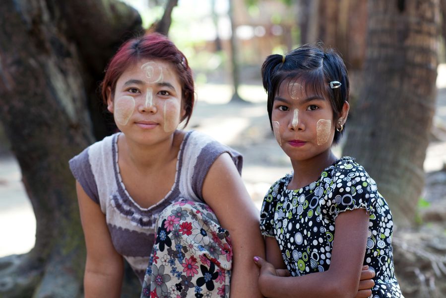
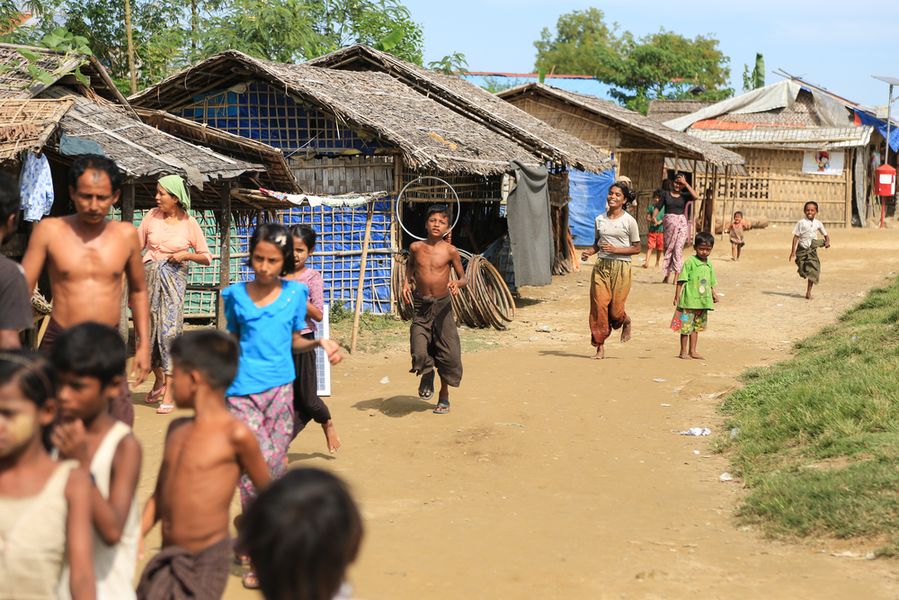
Burma or Myanmar, officially ‘Republic of the Union of Myanmar’, is located in Southeast Asia. It is bordered by Thailand, Laos, China, India and Bangladesh with 53.26 million populations. (The World Bank, 2015) It houses 135 different ethnic groups in which 8 major ethnic groups have played a vital role in its national history. Those are Bamar, Mon, Shan, Karen, Kachin, Chin, Karenni and Rakhine. The seven territories in Myanmar are named after the seven major ethnic groups except Bamar whose name pronounces the major ethnic group consisting of other groups in 7 divisions: Sagaing, Mandalay, Bago, Yangon, Irrawadi, Magway and Tanintharyi.
Besides the major ethnic groups, other groups are Tanu, Taungyo, Tae, Maramagyi, Daingnet, Yintale, Rawang, Lisu, Lahu, Kaw, Hkahku, Lashi, Khami, Naga, Maw, Wa, Palaung, Pale, Pyin, Pa-O, Salon, Zayein, Yin Baw, Bre, Padaung , Yin Talai, Khamti, Yo, Lem , Khamu, Lu and Hkun.
These ethnic groups unevenly dwell on highlands and the mountainous North, West and East while only a few live in the South. The Burmese themselves are not well familiar with the ethnic groups as most of which live closer to nature. Kokang and Wa living in Chan near Chinese border are the two groups causing considerable concerns to the Burmese government due to their drug trafficking. The Wa group later has expanded their boundary to Thai border. The Naga group, however, has raised another concern as they live near the Indian border. Their lifestyle is closer to nature but in a primitive way in which they are still hunting for human heads. Meanwhile, the Long Neck Karen or Padong group has their lifestyle and culture attracting visitors and tourists. Intha is another group living nearby the Inle Lake in Chan. (วิรัช นิยมธรรม และ อรนุช นิยมธรรม, 2551:2)
Myanmar expands 675,552 square kilometers ranging 920 kilometers from East to West and 1,450 kilometers from North to South. Its border is 5,102 kilometers consisting of high range mountains and plateaus surrounding the central plain located at the heart of the country. It can be simply put that the topography is horseshoe-shaped. Therefore, the landscape naturally divides Myanmar into two parts. The central part located at the heart of the country is the basins such as southern Irrawadi basin, Sittoung basin and Chindwin basin while the high range mountains make natural borders lying from the West to the East and even the North. The mountainous areas take up 2/3 areas of the country. (พรพิมล ตรีโชติ, 2542:5-6)
The Bamar group, the dominant group, usually lives nearby the rivers such as Irrawadi River, Sittoung River and Chindwin River with Mon and Karen emigrating from high mountains. Other ethnic groups live on plateaus or high range mountains on the frontiers. Thus, the difficult landscapes make interactions between the minority groups on the frontiers and the Bamar people less accessible. The transportations on the high range mountains and thick woods do not allow many forms of travels except walking or a caravan with animal vehicles like elephant, horse, cow, buffalo and donkey. High-range mountains and plateaus naturally set borders against the minority groups and segregate them out of the federal power of the state. (พรพิมล ตรีโชติ, 2542:5-6)
Before 1824 when Myanmar had been the British colony, each ethnic group was autonomous. The federal state never intended to unify these groups as part of its structure, but, instead, allowed freedom for them to rule themselves. Seniors officials were sent out to different autonomous areas so that they could do consulting and collect taxes. However, they never intervened the internal administrations or the policies ruling the minority groups. It was distribution of authority to former rulers of the city-states. The relation between the minority groups and the federal government has been rare while the relations between the subjects and their local rulers have been stronger. Thus, it is inevitable that a sense of belonging to that ethnic group and a bond with its ruler has by far deepened in the mind of people rather than identifying oneself as a member of the state. It is a major problem in building a nation after Myanmar has declared its independence. (พรพิมล ตรีโชติ, 2542:9-10)
When Myanmar fell under British rule in 1824, there are many ethnic conflicts. The first one was Burmese landscapes that naturally segregated the ethnic groups from each other. High mountains, thick woods and rivers never allowed possible transportations, yet enhanced the differences in cultures and languages of the ethnic groups. A process of learning about each other and winning acceptances was unlikely to happen. When Britain ruled over Myanmar in 1886, it employed a policy of ‘divide and rule’ in which the central part and the borders of Myanmar were completely separated. Britain let each border state continue the former rule over themselves under the British high commissioners. Meanwhile, Britain employed the two-house system in the central part. In short, the British policies during the colonial time made it impossible for the ethnic groups to form an alliance and caused numerous conflicts. (พรพิมล ตรีโชติ, 2542:9-10)
Myanmar declared its independence in 1948, but Britain had left serious conflicts between the ethnic groups unresolved. It has become a burden of every Burmese government. Since 1948, the government has had one strategy attempting to unify the ethnic groups as part of Republic of the Union of Myanmar. Though details regarding the leaders’ attitudes towards the conflicts have been different, the strategy is all the same; maintain a unity of Myanmar. (พรพิมล ตรีโชติ, 2542:10)
In 1947, U Aung San was in power and trying to carry out the ‘Panglong Agreement’ which focused on the autonomous rights of the ethnic groups. However, U Aung San was later assassinated. The Panglong Agreement has never been successful until now.
Myanmar now identifies a state where it is a habitat of a minority group such as Kachin State, Chan State, Kayah State, Karen State, Mon State, Rakhine State and Chin State. Division is a term for Bamar-populated areas such as Sakang Division, Magwa Division, Bago Division, Mandalay Division, Irrawadi Division, Tanintharyi Division and Yangon Division. (พรพิมล ตรีโชติ, 2542:11)
Bibliography
พรพิมล ตรีโชติ. (2542). ชนกลุ่มน้อยกับรัฐบาลพม่า. กรุงเทพมหานคร: โรงพิมพ์มหาวิทยาลัยธรรมศาสตร์.
วิรัช นิยมธรรม และ อรนุช นิยมธรรม. (2551). เรียนรู้สังคมวัฒนธรรมพม่า. พิษณุโลก: โรงพิมพ์ตระกูลไทย.
The World Bank. (2015). Data. Retrieved 10 19, 2015, from The World Bank: http://data.worldbank.org/indicator/SP.POP.TOTL


